


Top 16 Car Camping Spots with Epic Views
Since the pandemic has halted travel for the time being, add these spots to your list of future spots to hit once it’s safe to travel.
Luno asked, “Where are your favorite places to car camp with epic views?” and as it turns out, you all have really good taste. After going through the submissions, we compiled a list of the top places to car camp with epic views by region. Elevate your next car camping adventure with an unbeatable view no matter where you’re travelling.
Western U.S.

1. Trona Pinnacles, CA
Just 28 miles outside of the Mojave Desert sit the Trona Pinnacles, a collection of 500 tufa spires (some up to 140 feet tall) scattered across the barren landscape. The stunning and unique area has been featured in countless commercials, photo shoots and movies, including Planet of the Apes and Star Trek: The Final Frontier. Camping here is free and managed by the Bureau of Land Management (BLM). Check out the BLM website to learn more about getting to the Trona Pinnacles.
Coordinates: 35.6177° N, 117.3681° W

2. Moab, UT
Moab, UT is a camping mecca, neighbored by two National Parks, one state park, and a massive expanse of BLM land. campgrounds. A red-rock wonderland, Arches National Park is filled with beautiful, naturally-occurring rock formations and sits only 5 miles outside of Moab.The park has over two thousand stone arches, hundreds of soaring pinnacles, and massive boulders. Canyonlands National Park, just 55 miles away from Moab, is filled with vast canyons and buttes formed by the Colorado River.
Coordinates: 38.7331° N, 109.5925° W

3. Manti-la sal
About 150 miles east from Moab is the Manti-la sal National Forest. This beautifully diverse landscape is home to canyons, mountaintops, meadows, lakes, and streams. Visitors can hike, climb, fish, horseback ride, mountain bike and even waterski. To learn more about reserving one of the 32 development campgrounds in the National Forest, visit the National Forest Service website.
Coordinates: 39.2833° N, 111.4246° W

4. Grand Staircase, Escalante, UT
Only a few hours from the north rim of the Grand Canyon is the Escalante National Monument Grand Staircase. The National Monument spans over 1 million acres and is split up into three sections: Grand Staircase, Kaiparowits, and Escalante Canyon. The landscape ranges from a low-lying desert to a wide conifer forest due to the land adapting for almost 200 million years. There are two official campgrounds in the monument, the Deer Creek Campground and the Calf Creek Recreation Area Campground, but you can find dispersed camping in the surrounding area for miles.
Coordinates: 37.7703° N, 111.6021° W

5. Goblin Valley State Park, UT
Named after its sandstone formations and hoodoos that resemble goblins, Goblin Valley State Park is another Utah beauty to add to your list. Visitors can explore the labyrinth of slot canyons off trail or cruise through the park’s trail system to see everything the park has to offer. Goblin Valley is well known for having barely any light pollution, making it a perfect place to stargaze. You can reserve one of the park’s 13 standard campsites on reserveamerica.com.
Coordinates: 38.5737° N, 110.7071° W

6. Sierra Buttes, CA
Surrounded by the dozens of alpine lakes and lush forests in Northern Sierra’s Lakes Basin Recreation Area, you’ll find the jagged tops of the Sierra Buttes. This show-stopping recreational area has over 30 miles of trails to explore along with fishing, hiking, kayaking, cross-country skiing, snowshoeing, snowmobiling, and 4-wheel driving. To learn more about Lakes Basin Recreation Area campgrounds, visit their website.
Coordinates: 39.6117° N, 120.6654° W

7. Alabama Hills, CA
Near the eastern slopes of the Sierra Nevada mountains is a congregation of eroded hills and wild rock formations. Alabama Hills is a hot spot for climbers and boulderers looking for a free space to explore. BLM manages three campgrounds near Alabama Hills: Lone Pine, Tuttle Creek and Portagee Joe. You can learn how to get to each site on the BLM website.
Coordinates: 36.6100° N, 118.1000° W

8. Sheep Bridge BLM area, UT
Just outside of Zion National Park is a secluded BLM site on Sheep Bridge Road, surrounded by red and orange towering mesas with a killer view of the edges of Zion National Park. The primitive campsites are free and have fire rings marking them. Stay up and check out the clear night sky and start off the next morning on the biking, hiking and off-roading trails just off of the dirt road. For instructions on how to get to the BLM sites, check out The Dyrt.
Coordinates: 37.196185° N, -113.217652° W

9. Joshua Tree National Park, CA
Incorporating both the Mojave Desert and Colorado Desert, Joshua Tree National Park is an expansive landscape of unique beauty. There are hundreds of developed campsites and dispersed camping within the park and its surrounding areas. The peak season is from August to early June due to the extreme temperatures of the desert in the mid-summer. The National Park bases its camping regulations and rules around the time of the year you visit, so visit the National Park website to plan your trip accordingly.
Coordinates: 33.8734° N, 115.9010° W

10. Big Sur, CA
If there was ever a perfect, idyllic car camping view, you would find it in Big Sur. This famous stretch of California coastline follows State Route 1 on a towering, winding seaside road. Although no camping is allowed along the highway, Big Sur offers streamside, oceanview and bluff camping in private campgrounds, state parks and dispersed campsites. You can visit Big Sur’s official website to learn more about the different car camping spots.
Coordinates: 36.2704° N, 121.8081° W

11. Black Canyon of the Gunnison National Park, CO
Little known even to some Colorado natives, the Black Canyon of the Gunnison is an astonishing wonder carved into southwestern Colorado. If you’re looking for epic views, the North Rim Campground is just steps away from amazing lookouts and a system of trails that lead down into the canyon. Some sites are just a couple hundred feet from the steep, granite walls where you can watch the local birds of prey nose dive through the cliffs...all while having your morning coffee. These sites are first-come, first-served and are closed during the winter season.
Coordinates: 38.5867° N,, -107.71026° W

12. Stanley Lake, ID
An alpine lake at the foot of the Sawtooth Mountains, Stanley Lake is perfect for fishing, boating, water skiing, jet skiing, swimming, canoeing and kayaking. Stanley Lake is situated in the Sawtooth National Forest, which is known as the crown jewel of the Gem State due to its remote wilderness and stunning landscapes. Although there are dozens of campgrounds in the National Forest, Stanley Lake Campground is known for its hilltop views and lush pine forest. To learn more about dispersed camping near Stanley Lake, visit the National Forest website.
Coordinates: 44.2440° N, 115.0587° W
Pacific Northwest

13. Mt. Hood National Forest, OR
Don’t let the partially active volcano scare you. Mt. Hood is a beautiful wonder filled with outdoor recreation in all seasons. Skiing, foraging, camping, and hiking are just a few of the activities you can do in the National Forest. Mt. Hood National Forest has over 70 campgrounds and ample opportunity for dispersed camping. Make sure to check with the National Forest website before you go to learn more about the operating rules and regulations for primitive and developed camping.
Coordinates: 45.3736° N, 121.6960° W
Eastern U.S.

14. Pisgah National Forest, NC
In the mountains of Western North Carolina, the Pisgah National Forest houses a 2,000 ft deep gorge filled with massive rock formations, dense forest land with whitewater rivers, and a widely loved waterfall called Linville Falls. The National Forest has dozens of official campgrounds with some dispersed camping available. Generally, the dispersed camping is hike-in and tent only but check out the National Forest website for more information on how to get a spot.
Coordinates: 35.2847° N, 82.7270° W
Southern U.S.

15. Talimena State Park, OK
Settled in the Ouachita National Forest of Oklahoma, this state park is known for its rolling hills and vibrant foliage landscapes during the spring. Talimena State Park is a gateway to the Talimena National Scenic Drive, a scenic byway that follows the Winding Stair Mountain to Arkansas. You can backpack, hike, ATV, or dirt bike your way through the National Forest. Check out the Travel OK website to book a campsite.
Coordinates: 34.7850° N, 94.9530° W

16. Cherokee National Forest, TN
Cherokee National Forest, the largest stretch of public land in Tennessee, spans 640,000 acres in the Southern Appalachian Mountains. Along with trekking the 150 miles of the Appalachian National Scenic Trail, visitors can enjoy fishing, wind sailing, water skiing, boating, hiking and equestrian trails. There are over 30 developed campsites in the National Forest. To learn more about reserving a campsite, visit the National Forest website. Dispersed camping is allowed throughout the National Forest, but camping isn’t allowed within 100 feet of water, trails, trailhead parking lots and developed recreation areas.
Coordinates: 36.2033° N, 82.1492° W
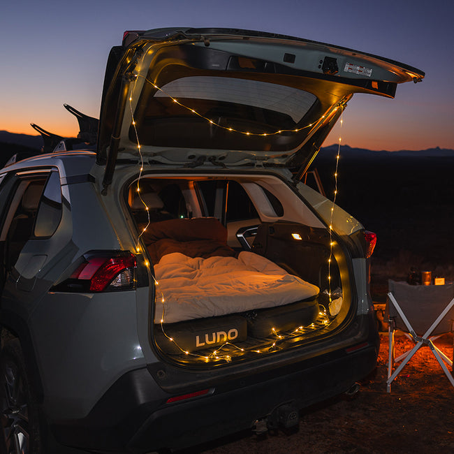
Ready to hit the road and see some epic views? The Luno Car Air Mattress is the perfect setup for your next car camping trip, whatever the season, whatever the adventure. Follow us on Instagram at @LunoLife & tag us in your favorite epic camp view.

